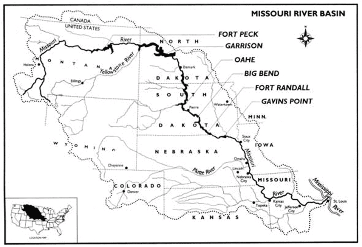
The Missouri River is the longest river in the United States at 2,341 miles. The river that we know today was born out of the 1945 Rivers & Harbors Act, as authorized by Congress, which created the Bank Stabilization and Navigation Project (BSNP) and was completed in 1980. The BSNP established today’s 300-foot wide by 9-foot deep self-scouring navigation channel through a series of rock dikes and revetments. It also stabilized the banks, set the channel in place and allowed sediment to deposit and land to accrete, creating the fertile bottomlands that we know today.
Agriculture is the dominant land use within the lower Missouri River basin, accounting for as much as 72% of river bottom acres.[1]
Nearly 5 million tons of cargo was shipped on the Missouri River, trending upward since 2011. Commercial sand and gravel shipments were responsible for 4 million tons.
41 water intakes exist below Gavins Point Dam – 18 municipal, 12 public, 10 domestic and 1 commercial/industrial. 14 power plants operate downstream of Sioux City, Iowa.[2]
Importantly, Missouri River flows aid the middle-Mississippi River between St. Louis, Missouri and Cairo, Illinois as much as 72% of the flow during the 2012 drought.[3]